Summary
The EMMA project is building new tools to monitor the health of shrubland ecosystems in near real-time. Focusing on the fire-prone Cape Floristic Region of South Africa—a biodiversity hotspot—our system combines satellite data, field observations, and modeling to track changes in vegetation, identify threats like fires or invasive species, and support better conservation decisions. In partnership with the South African Environmental Observation Network (SAEON), EMMA aims to provide reliable, up-to-date information that helps protect these critical landscapes.
Cape Floristic Region
The EMMA project focuses on the Cape Floristic Region of South Africa — one of the most biologically diverse and ecologically important areas on Earth. Despite covering less than 0.5% of Africa’s land area, this region holds over 20% of the continent’s plant species, many of which are found nowhere else.
This unique shrubland ecosystem, known locally as fynbos, is shaped by fire, climate, and human activity. It is a UNESCO World Heritage Site and a Global Biodiversity Hotspot, but faces growing threats from climate change, land use change, and invasive species.
By combining Earth observations with ecological models, EMMA supports real-time monitoring and decision-making to help protect and manage this remarkable landscape.
Park-level Summaries
Click on a park below to view park specific reports.
Regional Overview
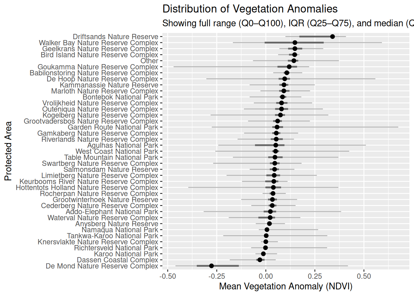
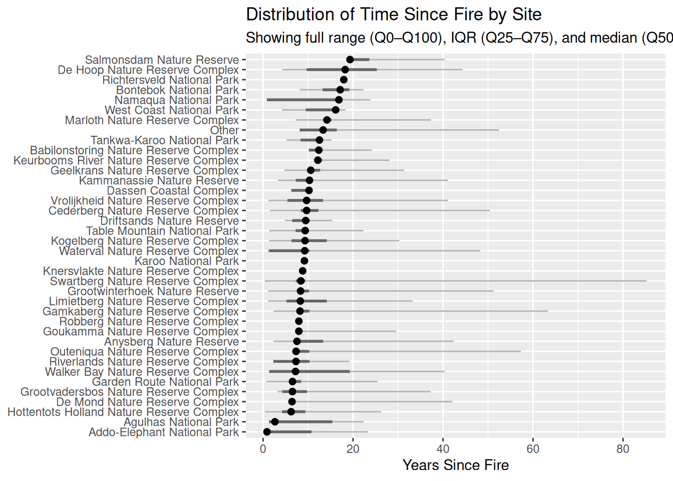
Stand Age distributions
Data Overview
See table below for dates each dataset was last updated and download links.
| Description | Date last updated |
|---|---|
| Website | 2025-Sep-14 |
| NDVI | 2025-Jan-17 |
| Weather | 2025-Aug-24 |